We own and operate Victoria’s electricity transmission network and one of the five distribution networks.
Each year our Aerial Operations Program inspects around 40,000 poles on our electricity network from the air.
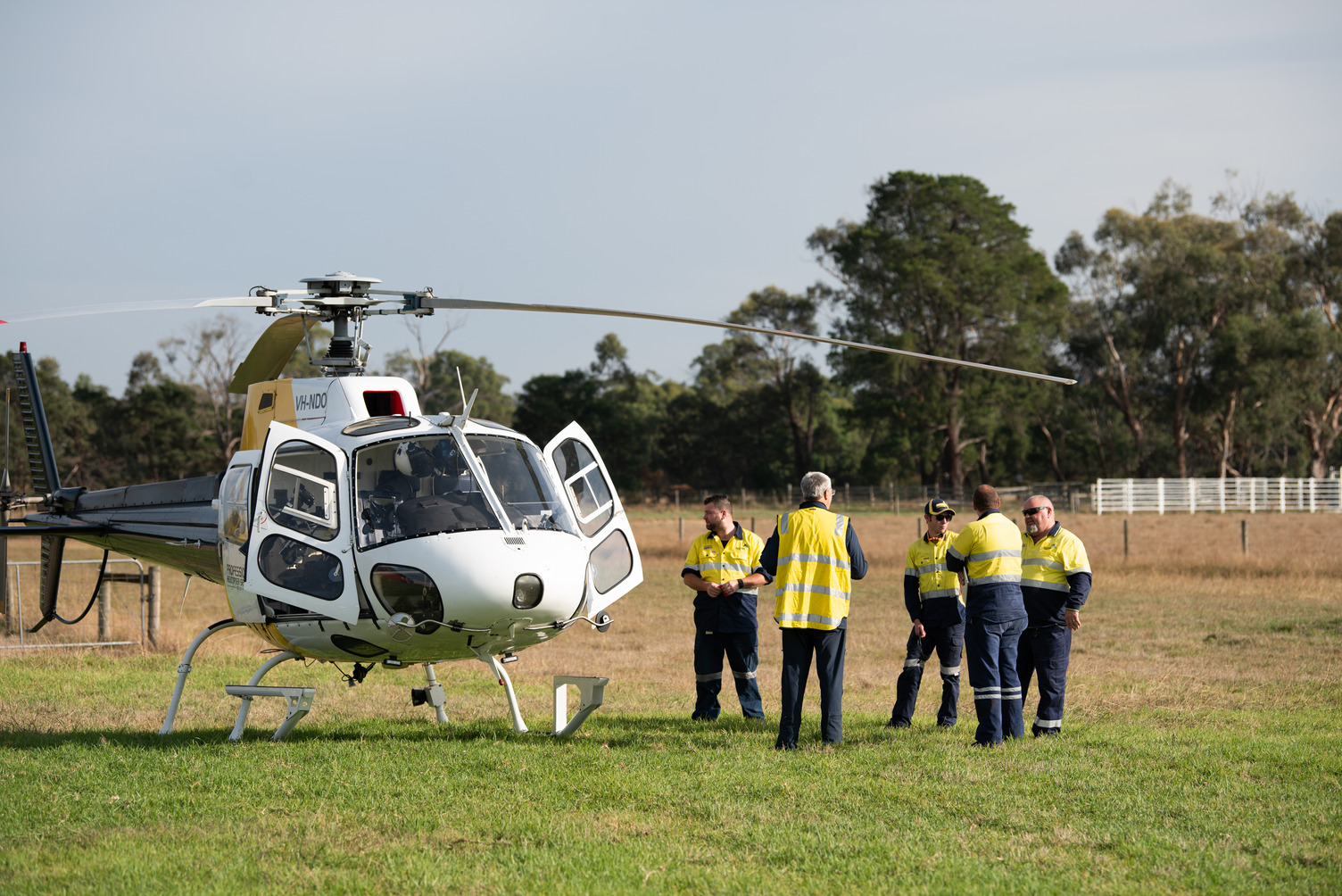
We use specialised helicopters and crew to thoroughly inspect overhead powerlines and poles to make sure the electricity supply across the AusNet distribution network remains safe and reliable.
Why we use helicopters
Helicopters significantly reduce the time taken to inspect an area. They allow a bird’s-eye view for us to identify, monitor and repair any wear and tear or potential risks to supply, such as deterioration on the topside of poles.
We're aware that noise from helicopters can present a risk to some livestock. That's why our specialised pilots remain alert for livestock and, where possible, change course to avoid unsettling animals.
Playing a vital role in keeping communities safe
Our aerial team also provides rapid response to assess damage and resolve any faults/outages that occur on the network after a severe weather event, such as storms, floods, or bushfires.
SAIP Patrols – 11 to 24 May 2026
From Monday 11 to Sunday 24 May 2026, we'll be conducting inspections on our transmission network using a smart aerial image processing system (SAIP).
This system uses a high-resolution image capture program to capture a continuous stream of digital images of all 6500 kilometres of our high-voltage powerlines. Its software then processes the images and identifies any potential defects.
These inspections help us provide safe and reliable electricity to our communities. The maps below show where you may see our helicopters. You can also download a full list of locations (Excel, 14KB).
Want SMS alerts about upcoming aerial inspections in your area? Make sure your electricity retailer has your mobile number, they’ll pass it onto us so we can start sending you updates.


Pre-winter patrols 2026
From Wednesday 13 to Friday 15 May 2026, we'll be doing pre-winter patrols of our high-voltage powerlines in Alpine areas.
Our aerial team will be inspecting our major 22kV feeders so we can identify and repair any potential defects on our network before winter. These inspections help us to provide safe and reliable electricity to our communities.
The map below shoes where you may see our helicopters. You can also download a full list of locations (Excel, 18KB).

